Tourist Attractions
Penna River
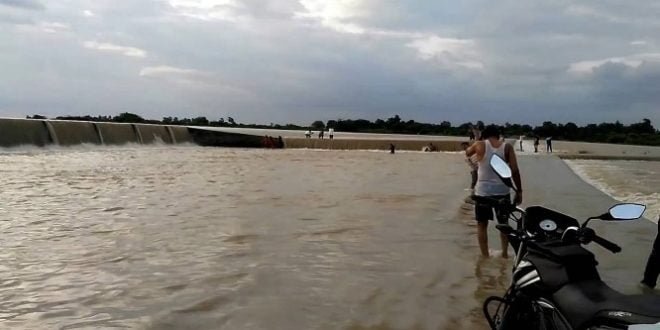
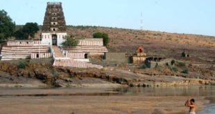
River Penna at Adinimmayapalli

Penna River

Name of the River : Penna or Pennar

Rises from : Chenna Kesava hills of the Nandi ranges of Karnataka

Outfalling into : Bay of Bengal (at a place called Utukuru, 15 km east of Nellore)

Principal tributaries : Jayamangal (Left side), Kunderu or Kundu (Left Side) , Sagileru (Left Side), Chitravati (Right Sode), Papagni (Right Side) and Cheyyeru (Right Side)

Length (in Km) : 597

Catchment Area (Sq.km.) : 55213

Average Water Resource Potential (MCM) : 6320

Utilizable Surface Water Resource (MCM) : 6900

Live Storage Capacity of Completed Projects (MCM) : 2809.00

Read :  Pushpagiri - Hub of Temples

Live Storage Capacity of Projects Under Construction (MCM) : 440.0

Total Live Storage Capacity of Projects (MCM) : 3249.0

No. of Hydrological Observation Stations (CWC) : 8

No. of Flood Forecasting Stations (CWC) : 1


Check Also

Attirala

Attirala (Hatyarala) Sacred Temples

There is the temple of sri Thretheswara swamy in the form of a stone sivalingam. This temple is picturesquely situated on the bank of the river Bahuda (Cheyyeru) on a hillock with a beautiful Kalyana mantapanm (marriage hall) and gali gopuram (tower). The hillock is known as Thretachalam on account of the manifestation of Threteswara swamy.

శత్రు దుర్భేద్యమైన గండికోట

ఆయనకు ఆ స్థలం బాగా నచ్చింది. ఆ కొండ కోట నిర్మాణానికి ఎంతో అనువుగా ఉందనీ, అక్కడ కోటను నిర్మిస్తే ఆ చుట్టు పక్కల గ్రామం వెలసి సుసంపన్నంగా, ఎంతో వైభవంగా కళకళలాడుతుందనీ జ్యోతిష్కులు శెలవిచ్చారు. దాంతో కాకమహారాజులు అక్కడ కోటను నిర్మించాలని అనుకున్నాడు. వైకుంఠశుద్ధ పంచమి రోజున కోట నిర్మాణానికి శంకుస్థాపన జరిపాడు. అతితక్కువ వ్యవధిలోనే అక్కడ గండికోట ఆవిర్భవించి దుర్భేద్యమైన కోటగా పేరు తెచ్చుకుంది.

Leave a Reply

Your email address will not be published. Required fields are marked *